Da Nang’s best scenic drives in 2026 combine 21 kilometers of legendary mountain switchbacks on Hai Van Pass with 15 kilometers of coastal jungle loop on Son Tra Peninsula, plus a 30-kilometer beachside highway to Hoi An — each offering a distinct driving experience that rewards early starts and flexible schedules. This guide breaks down seven routes with exact distances, drive times, difficulty ratings, and the practical details that turn a rental motorbike into your ticket to Central Vietnam’s most photogenic roads.
The seven scenic drives around Da Nang split into two camps: coastal routes that deliver ocean views with easy, flat riding, and mountain passes that demand focus but reward with panoramic overlooks. Hai Van Pass remains the region’s crown jewel at 21 km with 43 hairpin turns, while the Son Tra Peninsula loop offers the best wildlife encounters — red-shanked douc langurs appear along the road shoulder most mornings. Timing matters more than skill: February through August brings dry, clear conditions, while September through November introduces rain and fog that transforms mountain descents into low-visibility challenges.
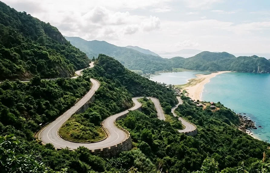
How to Choose the Right Scenic Drive for Your Trip
Da Nang’s scenic driving network offers seven distinct routes, each with its own character, difficulty level, and ideal vehicle. The selection process starts with three questions: how much time you have, what kind of vehicle you’re comfortable handling, and which scenery matters most to you — ocean views, mountain panoramas, or cultural stops.
Coastal vs mountain pass: what each type offers
Coastal routes like the Vo Nguyen Giap beach highway and the My Khe to Lang Co stretch deliver flat, relaxed riding with continuous ocean views and easy access to beaches, cafes, and seafood stops. Mountain passes — Hai Van, Ba Na Hills road, and Deo Ca — provide elevation changes, switchbacks, and overlooks that coastal roads cannot match, but they demand more attention and better vehicle control.
Matching routes to your driving skill and vehicle
Automatic scooters (110cc) handle all coastal routes comfortably and manage Hai Van Pass with adequate power, though you’ll feel the strain on the steepest sections. Semi-automatic or manual bikes (125cc+) give better control on descents and hairpin turns. Cars work well for every route except the narrowest sections of Son Tra Peninsula’s unpaved tracks, where a motorbike’s maneuverability makes a difference.
Best months for each route in 2026
February through August delivers the most reliable driving conditions across all seven routes — clear skies, dry pavement, and ocean visibility that stretches for miles. September through November brings the rainy season: coastal roads stay passable but lose their postcard appeal, while mountain passes like Hai Van and Ba Na Hills can experience fog that reduces visibility to under 50 meters on the upper sections.
1. Hai Van Pass — The Legendary Mountain Road Connecting Da Nang and Hue
Hai Van Pass stretches 21 kilometers from the northern edge of Da Nang to the coastal plain near Lang, climbing to 496 meters above sea level at its summit. The road’s reputation as Vietnam’s most scenic coastal drive comes from the way it hugs the mountainside, offering continuous views of the East Sea on one side and jungle-covered peaks on the other.
Why this 21 km pass is still the region’s most iconic drive
Top Gear’s 2008 Vietnam special put Hai Van Pass on the global driving map, and the road has only improved since. The 43 hairpin turns create a rhythm that experienced riders find meditative, while the elevation gain provides natural air conditioning — temperatures drop noticeably as you climb. The pass’s historical significance adds another layer: the Hai Van Gate at the summit marks the traditional border between the Cham and Vietnamese kingdoms, and its weathered stone walls remain intact.
Key viewpoints: where to stop for the best photos
Number your stops along the pass to avoid missing the best angles:
- Vung Chua Dat viewpoint — the first major overlook on the Da Nang side, with a clear sightline down the coast toward Lang Co Bay
- The Hai Van Gate ruins — park at the summit and walk through the old stone archway for the classic “top of the pass” photo
- The Lang Co Bay overlook — located about 3 km past the summit on the Hue side, this spot frames the turquoise lagoon against the mountains
- The railway tunnel viewpoint — a lesser-known pull-off where you can watch trains emerge from the 6.3 km Hai Van Rail Tunnel below
Tunnel vs pass: when to take the old road vs the Hai Van Tunnel
The 6.3 km Hai Van Tunnel (opened 2005) bypasses the pass entirely and saves roughly 30 minutes for travelers heading to Hue. Take the tunnel when you’re on a tight schedule, carrying heavy luggage, or driving in poor weather. Take the old pass road when the scenery is your priority — the extra time costs nothing but delivers Vietnam’s most famous driving experience. Trucks and buses use the tunnel, which means the pass road sees mostly motorbikes and tourist cars, keeping traffic light and the atmosphere relaxed.
2. Son Tra Peninsula Loop — Coastal Views and Monkey Encounters
The Son Tra Peninsula — nicknamed Monkey Mountain by American soldiers during the Vietnam War — forms a 15-kilometer loop that starts just 10 minutes from Da Nang’s city center. The road climbs through protected jungle, hugs the coastline at several points, and delivers the region’s best chance to spot the endangered red-shanked douc langur in the wild.
The 15 km loop around “Monkey Mountain”
Start at the base near My Khe Beach and follow the road clockwise. The first 5 kilometers climb steadily through dense forest, where the canopy overhead filters sunlight into dappled patterns. At the 6-kilometer mark, the road emerges onto a cliff section with unobstructed views of Da Nang Bay and the Cham Islands on the horizon. The loop’s eastern edge drops toward Tien Sa Beach, where the road flattens and follows the shoreline for 3 kilometers before looping back.
Ban Co Peak viewpoint and the Linh Ung Pagoda stop
Ban Co Peak sits at 698 meters and offers the peninsula’s highest viewpoint — on clear days, you can see the entire Da Nang coastline from Son Tra to the Marble Mountains. The Linh Ung Pagoda, located at the 8-kilometer mark, houses Vietnam’s tallest Guanyin statue at 67 meters and provides a shaded parking area with a cafe. The pagoda’s sea-facing position makes it a natural mid-route break point.
Best time of day to drive the loop in 2026
Morning hours between 7:00 and 10:00 deliver the best wildlife viewing — red-shanked douc langurs are most active in the early hours before the heat builds. The afternoon brings more traffic from tour buses and photographers chasing sunset light. If you want the loop to yourself, start at 6:30 AM; you’ll have the road nearly empty and the best chance to see langurs feeding in the trees along the roadside.
3. Da Nang to Hoi An Coastal Route (Vo Nguyen Giap) — The Beach Highway
The 30-kilometer coastal highway from Da Nang to Hoi An runs along Vo Nguyen Giap Street, a wide, palm-lined boulevard that tracks the shoreline for most of its length. This route offers the easiest driving of any scenic drive in the region — flat, straight, and well-maintained — making it ideal for beginner riders or travelers who want to combine driving with beach stops.
My Khe and Non Nuoc beaches along the way
My Khe Beach anchors the route’s northern end, stretching 6 kilometers of fine white sand that Forbes magazine once named one of the world’s most beautiful beaches. Non Nuoc Beach takes over at the 15-kilometer mark, backed by the Marble Mountains and quieter than My Khe. Both beaches have easy pull-off parking and small cafes selling fresh coconut water and grilled seafood.
Marble Mountains as a mid-route stop
At the 18-kilometer mark, the Marble Mountains rise abruptly from the coastal plain — a cluster of five marble and limestone hills riddled with caves, pagodas, and viewpoints. A 2-hour stop here breaks the drive nicely: climb to the top of Thuy Son (Water Mountain) for panoramic views of the coast, explore the Am Phu Cave’s descent into a recreated underworld, and visit the marble carving villages at the base.
Evening option: driving back after sunset for lantern views
The route’s flat, well-lit highway makes it safe for evening driving, which opens up a popular itinerary: drive to Hoi An in the afternoon, wander the lantern-lit Ancient Town as dusk falls, and return to Da Nang after dinner. The return drive takes 45 minutes and passes through the An Bang Beach area, where several beachfront bars offer a final stop for a drink before reaching the city.
4. Ba Na Hills Road — The Mountain Ascent to the Golden Bridge
The 30-kilometer road from Da Nang to Ba Na Hills climbs from sea level to 1,487 meters at the cable car station, making it the steepest and most demanding drive in the region. The route passes through the foothills of the Truong Son mountain range, transitioning from coastal scrub to pine forest to cloud forest as elevation increases.
The 30 km winding climb from Da Nang to the cable car station
The first 15 kilometers run through flat farmland and small villages before the climbing begins in earnest. The final 15 kilometers feature continuous hairpin turns with elevation gains of 5-8% on the steepest sections — a serious workout for a 110cc scooter carrying two people. The road surface is well-maintained asphalt, but the constant turning demands attention. Allow 60-75 minutes for the full ascent.
Hairpin turns and fog conditions: what to expect
Fog becomes a genuine hazard above 800 meters, particularly between 10:00 AM and 2:00 PM when warm air meets the cool mountain slopes. Visibility can drop to 30 meters in the densest patches, and the road lacks guardrails on several outer curves. If fog rolls in, slow to 20-30 km/h and use your horn at blind corners — local drivers expect this and will appreciate the warning.
Where to park and how to combine with the cable car experience
The cable car station at Ba Na Hills has a large, secure parking area (approximately 20,000 VND per day for motorbikes, 50,000 VND for cars). The cable car itself holds two Guinness World Records — longest non-stop single-track cable car at 5.8 kilometers and the highest elevation difference at 1,291 meters. The Golden Bridge, held aloft by two massive stone hands, sits a short walk from the upper cable car station. Budget at least 4 hours at the top to explore the French Village, flower gardens, and the bridge itself.
5. My Khe to Lang Co Bay — The Extended Coastal Run
This 60-kilometer route extends the coastal driving experience beyond Da Nang’s immediate beaches, linking My Khe to the turquoise waters of Lang Co Bay. The route runs north along the coast, passing through fishing villages, over the southern edge of Hai Van Pass, and down into the Lang Co lagoon area — a journey that showcases Central Vietnam’s coastal diversity in a single drive.
The 60 km stretch linking Da Nang’s beaches to Lang Co
The route begins at My Khe Beach and follows the coast north through the Son Tra Peninsula’s southern edge before joining Highway 1A. The road passes through the small fishing village of Tho Quang, where colorful boats line the harbor, then climbs briefly over the southern shoulder of Hai Van Pass before descending to the Lang Co lagoon. The final 10 kilometers run along the lagoon’s edge, with the Truong Son mountains rising to the west and the East Sea to the east.
Fisherman villages and seafood stops en route
Tho Quang village offers the best seafood stop on the route — small family-run restaurants serve whatever the morning catch brought in, with grilled squid and steamed clams being local specialties. The village of Lang Co itself has a handful of seafood restaurants along the lagoon, where you can watch fishing boats return in the early afternoon. Prices here run noticeably lower than Da Nang’s beachfront restaurants.
How this route connects to Hue for a longer road trip
Lang Co Bay marks the gateway to Hue — the former imperial capital sits just 30 kilometers further north. This makes the My Khe to Lang Co run a natural first leg of a Da Nang to Hue road trip: drive the coastal route, stop for lunch at Lang, then continue to Hue’s Citadel and imperial tombs. The full Da Nang to Hue journey covers 100 kilometers and takes 2.5-3 hours with stops.
6. Deo Ca Pass (Cau Hai to Tuy Hoa) — The Remote Mountain Alternative
Deo Ca Pass, located roughly 150 kilometers south of Da Nang near the border between Thua Thien Hue and Phu Yen provinces, offers the region’s most remote and least-crowded mountain driving experience. The pass’s name translates to “Pass of the Song” — a reference to the wind that whistles through the valley — and its 12 kilometers of switchbacks deliver views that rival Hai Van without the tourist traffic.
Why this lesser-known pass is worth the detour
Deo Ca Pass receives a fraction of Hai Van’s visitors, which translates to empty roads and unspoiled viewpoints. The pass’s southern approach passes Vung Ro Bay, a deep-water harbor that played a strategic role during the Vietnam War and now offers some of Central Vietnam’s most dramatic coastal-mountain scenery. The pass itself climbs to 450 meters and features 27 marked switchbacks, each revealing a new angle on the bay below.
Road conditions and fuel stops in 2026
The Deo Ca Tunnel (opened 2017) now carries most through-traffic, which means the old pass road sees light usage and occasional maintenance gaps. The surface remains passable but watch for potholes on the upper sections — repair crews prioritize the tunnel route. Fuel stations are sparse: fill up at the Cau Hai lagoon area before starting the climb, as the next reliable station sits 40 kilometers south near Tuy Hoa.
Combining the pass with a visit to Da Nang’s southern countryside
Pair the Deo Ca drive with a loop through Da Nang’s southern countryside for a full-day adventure. The countryside roads between Da Nang and Cau Hai pass through rice paddies, pepper farms, and traditional villages where life moves at a slower pace. The combination delivers two distinct experiences in one day: mountain pass adrenaline and rural immersion.
7. The Hai Van to Hoi An Scenic Loop — The Full Circle Experience
This full-day itinerary links the region’s best driving roads into a single 180-kilometer loop, starting and ending in Da Nang. The route combines Hai Van Pass, the Son Tra Peninsula, the coastal highway to Hoi An, and the countryside roads on the return — a comprehensive showcase of Central Vietnam’s driving diversity.
How to link the pass, coast, and countryside in one day
The loop’s logic is simple: head north over Hai Van Pass in the morning when visibility is best, return south along the coast to Da Nang, continue to Hoi An on the beach highway, then loop back through the countryside on the western side. The route covers 180 kilometers with roughly 5-6 hours of driving time, leaving room for stops at the pass viewpoints, Son Tra, and Hoi An’s Ancient Town.
Suggested itinerary: morning pass, afternoon coast, evening Hoi An
- 7:00 AM — Depart Da Nang, head north toward Hai Van Pass (30 minutes to the base)
- 7:30–9:30 AM — Drive the pass, stopping at the summit gate and Lang Co overlook
- 9:30–10:30 AM — Descend to Lang, quick coffee stop at a lagoon-side cafe
- 10:30 AM–12:00 PM — Return south via the coastal road through Son Tra Peninsula, stopping at Linh Ung Pagoda
- 12:00–2:00 PM — Lunch at a My Khe Beach seafood restaurant
- 2:00–3:30 PM — Drive the Vo Nguyen Giap coastal highway to Hoi An
- 3:30–6:30 PM — Explore Hoi An Ancient Town, watch the lanterns light up
- 6:30–7:30 PM — Return to Da Nang via the countryside road, arriving after dark
Realistic driving times and where to break the loop
Add 30-45 minutes of buffer time to each leg of the itinerary — photo stops, traffic, and unexpected detours always take longer than planned. The best break points are the Hai Van summit (coffee and photos), Lang Co lagoon (lunch), and Hoi An (evening exploration). If you’re feeling tired by the Hoi An leg, break the loop there and take the flat, fast coastal highway straight back to Da Nang instead of the countryside route.
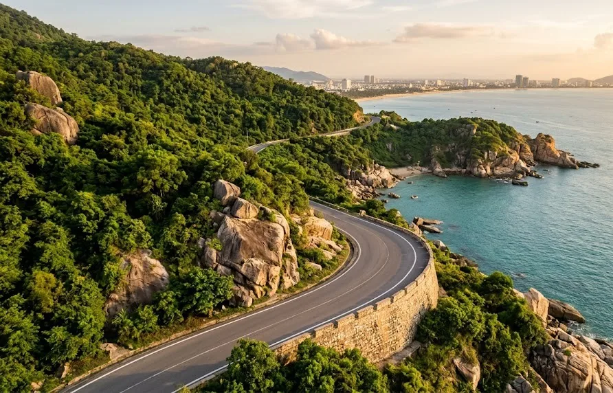
Comparing Da Nang’s Scenic Drives: Which One Fits Your Schedule
Each route serves a different purpose, and matching the drive to your available time and comfort level makes the difference between a memorable day and a stressful one.
Quick comparison: distance, driving time, difficulty, and highlights
| Route | Distance | Drive Time | Difficulty | Best For |
|---|---|---|---|---|
| Hai Van Pass | 21 km | 45–60 min | Moderate | Iconic mountain views |
| Son Tra Peninsula Loop | 15 km | 45–60 min | Easy–Moderate | Wildlife + coastal views |
| Vo Nguyen Giap to Hoi An | 30 km | 45 min | Easy | Beach highway + Hoi An |
| Ba Na Hills Road | 30 km | 60–75 min | Hard | Golden Bridge + mountain ascent |
| My Khe to Lang Co | 60 km | 1.5–2 hrs | Moderate | Extended coastal run |
| Deo Ca Pass | 12 km (pass only) | 30–40 min | Moderate–Hard | Remote, uncrowded pass |
| Hai Van to Hoi An Loop | 180 km | 5–6 hrs | Moderate | Full-day comprehensive drive |
One-day vs half-day vs multi-day route planning
Half-day options: Son Tra Peninsula Loop (2-3 hours) or Vo Nguyen Giap to Hoi An (3-4 hours including stops). Full-day options: Hai Van Pass with a Lang Co lunch (5-6 hours), My Khe to Lang Co with a Hue extension (8-9 hours), or the complete Hai Van to Hoi An Loop (10-12 hours). Multi-day plans should combine the Hai Van Pass and Hue leg with the coastal routes on separate days to avoid driving fatigue.
Budget considerations: fuel, tolls, parking, and food
Fuel costs run approximately 50,000-80,000 VND per 100 kilometers on a 125cc motorbike (about 22,000 VND per liter). Parking fees range from 10,000-20,000 VND at pagodas and viewpoints, up to 50,000 VND at Ba Na Hills. The Hai Van Tunnel charges 45,000 VND for cars and 15,000 VND for motorbikes. Food costs vary widely: a seafood lunch at a beachfront restaurant runs 150,000-300,000 VND per person, while village eateries serve filling meals for 50,000-80,000 VND.
Essential Tips for Driving Da Nang’s Scenic Routes in 2026
The difference between a smooth scenic drive and a stressful one often comes down to preparation — vehicle choice, packing, and knowing what’s changed on the roads this year.
Renting a motorbike vs car: which works for each route
Motorbike rental in Da Nang runs $5-8 per day for an automatic scooter, $8-12 for a semi-automatic or manual bike. Rent from a shop that includes helmets and shows you the bike’s maintenance history — several Da Nang rental shops have been flagged for renting bikes with worn brakes or bald tires. Cars cost $30-50 per day with a driver or $25-40 for self-drive, though self-drive car rental requires an International Driving Permit and a Vietnamese temporary license, which takes 2-3 days to arrange.
Road safety, weather, and what to pack for mountain passes
Pack a light rain jacket even in dry season — mountain weather shifts quickly, and the temperature drops noticeably with elevation. Bring a phone mount with GPS, a portable charger, and a basic toolkit (tire repair kit, small wrench). On mountain passes, use engine braking on descents rather than riding the brakes — this prevents brake fade, which is the most common cause of motorbike accidents on Hai Van and Ba Na Hills roads.
New in 2026: road updates, toll changes, and route closures to know
Several road improvements affect scenic driving in 2026. The Hai Van Pass road surface received a full resurfacing in late 2025, smoothing out the worst patches. The Son Tra Peninsula road has new guardrails on the cliff sections, but the unpaved tracks to the peninsula’s northern beaches remain rough. The Vo Nguyen Giap highway has new traffic lights at the An Thuong intersection — expect short delays during peak hours. No major toll changes have been announced for 2026, but the Ba Na Hills parking area has expanded with a new overflow lot for motorbikes.
Before any of these routes, run through this.

Essential Pre-Drive Checklist for Da Nang’s Scenic Routes
Before hitting the road, ensure you have all necessary documents and equipment. As per 2026 regulations, foreign nationals driving motorbikes in Vietnam need a valid International Driving Permit (IDP) that has been officially translated and notarized. If you are renting a vehicle, request a rental agreement and insurance from the owner. For cars, you will need an IDP and a temporary permit issued by the relevant authorities. Always carry your original passport and a notarized copy.
Packing list:
- Raincoat and jacket: Central Vietnam’s weather can change rapidly, especially on Hai Van Pass and Ba Na Hills.
- Camera and power bank: Every stop offers breathtaking scenery.
- Offline maps: Google Maps works well in populated areas, but Maps.Me or OsmAnd will be more useful on Hai Van Pass and Son Tra (where phone signal is weak).
- Cash: Toll stations, parking lots, and small eateries often do not accept cards. Carry 500,000-1,000,000 VND for each trip.
- Water and snacks: There are very few food options on Hai Van Pass and Son Tra—purchase supplies at convenience stores in the city center.
Fuel stations and rest stops: Before heading up Hai Van Pass, refuel at stations on Nguyen Tat Thanh Street (Lien Chieu). There are no fuel stations on Son Tra Peninsula—fill up your tank before you go. In the Marble Mountains and Non Nuoc area, you’ll find numerous eateries and convenience stores along the road. If you are taking the coastal road to Hoi An, there is a fuel station at the Dien Ban intersection (5 km before Hoi An). Always carry cash for parking fees and entrance tickets—locations like Marble Mountains and Linh Ung Pagoda only accept cash.
Related on this site
- My Son Sanctuary: Ancient Champa Ruins Near Da Nang 2026
- Da Nang’s Best Bike Rental Shops and Guided Tours 2026
- Historical Walking Tours: Discover Da Nang on Foot
Frequently Asked Questions
Do I need an international driving permit to ride a motorbike in Da Nang?
Yes — Vietnam requires an International Driving Permit (IDP) with a motorcycle endorsement for legally riding a motorbike. Rental shops rarely check, but police checkpoints do, and riding without a valid permit can result in fines of 2-4 million VND and bike impoundment.
Which scenic drive is best for a beginner rider?
The Vo Nguyen Giap coastal highway to Hoi An is the safest starting point — flat, straight, and well-maintained with minimal elevation changes. The Son Tra Peninsula Loop is a good second ride, with moderate hills but no steep switchbacks.
How long does it take to drive from Da Nang to Hue via Hai Van Pass?
The full journey covers 100 kilometers and takes 2.5-3 hours by motorbike, including stops at the pass viewpoints and lunch at Lang Co. Driving via the tunnel cuts the time to 2 hours but skips the scenic highlights.
Is it safe to drive the scenic routes during the rainy season?
Coastal routes remain safe in light rain, but mountain passes become hazardous — wet pavement reduces grip on switchbacks, and fog limits visibility. If you must drive in rain, stick to coastal routes and avoid Hai Van and Ba Na Hills roads.
What is the speed limit on these scenic routes?
Speed limits range from 40 km/h on mountain passes to 60 km/h on coastal highways. Police occasionally set up speed checks on the Vo Nguyen Giap highway, so keep your speed moderate even when the road feels empty.
Are there fuel stations along the scenic routes?
Da Nang’s outskirts have frequent fuel stations, but coverage thins on mountain passes. On Hai Van Pass, the nearest stations are at the base on either side. On the Deo Ca route, fill up at Cau Hai before climbing — the next station is 40 kilometers south.
Can I do the Hai Van to Hoi An Loop on a 110cc scooter?
Yes, but expect slower climbing on the pass — a 110cc scooter with two riders will drop to 30-40 km/h on the steepest sections. A 125cc bike provides noticeably better control and climbing power, making the loop more enjoyable.
Conclusion
Da Nang’s scenic driving network offers something for every traveler — the legendary Hai Van Pass for mountain views, the Son Tra Peninsula Loop for wildlife and coastal jungle, the Vo Nguyen Giap highway for relaxed beach cruising, and the full-circle loop for a comprehensive day of exploration. Choose your route based on time, skill, and the type of scenery you want to prioritize, then build in buffer time for photo stops and unexpected discoveries. The best scenic drives reward those who plan ahead — and the memories last long after the engine cools.
Part of our guide to places to visit in Da Nang.
The big one is its own guide: riding the Hai Van Pass from Da Nang.